Oxford Parking and Transportation Advisory Board reviews Bike and Pedestrian Master Plan recommendations
Firm gives suggestions to improve transit stop access, pedestrian infrastructure.
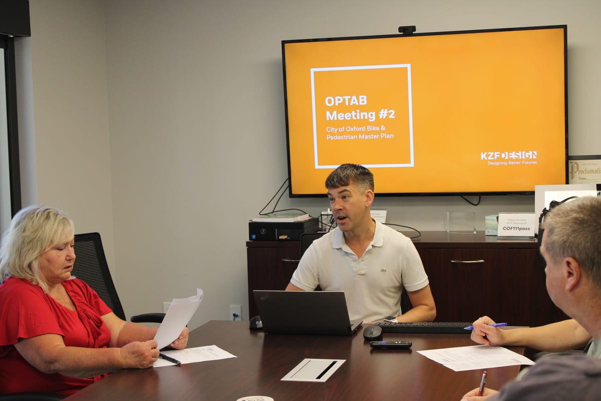
The Oxford Parking and Transportation Board reviewed recommendations for its Bike and Pedestrian Master Plan during a regular meeting Monday.
The plan, according to Community Development Department Director Sam Perry, began with a grant that was awarded to the city through the Butler County Regional Transit Authority. The grant funded a study to improve access to transit stops and the ability to use bicycle and pedestrian infrastructure as a means to get to and from those stops.
The grant, which falls under the Federal Transit Authority’s “Areas of Persistent Poverty Program,” Perry said, is $150,000 in total. But if the designs from the project are completed, he said it could cost up to millions through a combination of city and grant dollars.
“Everything from one small intersection improvement with some curb bump outs to kind of make it more clear where pedestrians cross to a million, multi-million dollar entire-street corridor road-narrowing, or something like that, and everything in between,” Perry said, listing examples of the projects that could be costly for Oxford.
“By doing estimations of the projects … we can have a number to attach if our elected officials decide, ‘Oh, we want to plan for doing this project in the future,’” he said. “Well, then we’ll set aside some money for what we call the local match, and then we’ll seek funding from one of the funding agencies that we will work with for the rest … and put those two together.”
Eric Anderson, vice president and director of planning for KZF Design, who presented the recommendations Monday, said there was a virtual open house, including a survey and an online map where residents could add comments, notes and points where there were safety concerns earlier this year.
Anderson said the agency also reviewed crash data in the city and accident reports.
KZF Design previously worked on planning projects for the Oxford Area Trails System (OATS). Bayer Becker, a civil engineering firm, and 143 Engineers are also assisting with the plan, Anderson said.
“This project is not in response to any particular concerns,” Perry said, although Anderson said there was significant feedback about bike and pedestrian safety and traveling through the city as a result of the survey.
“It’s a proactive project,” Perry said.
Perry said the Oxford City Council adopted a comprehensive plan that addressed these issues in 2014, although the new master plan would prioritize the locations of where improvements should be made and include engineering designs and estimates.
The master plan should be complete by the winter, and designs are expected to be complete by spring 2026, Perry said. The next step will be to have an in-person open house to decide which of the improvements are the most important on Sept. 17.
“If we decide to do a project, we can just pull it off the shelf and say, ‘We want to fix this street, and here’s the estimated cost.’ And we can seek funding for that,” Perry said.
Overall, Perry said the two “big wins” that could come out of the plan would be better access to transit stops and safer mobility for non-vehicular transportation.
“Might take a while, but if you don’t plan for it, it definitely won’t happen,” he said.
Recommendations
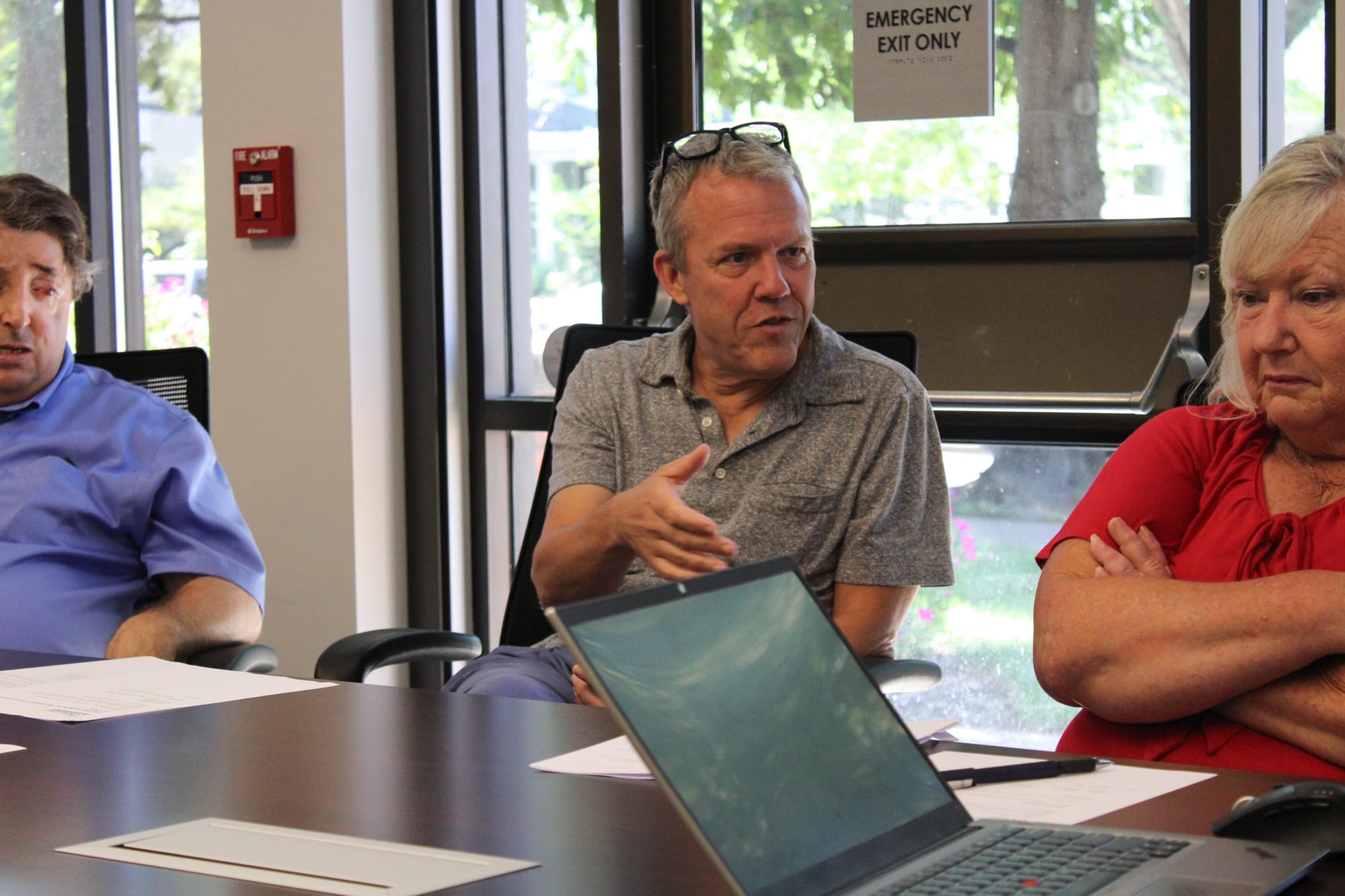
Anderson provided the board with several suggestions for a list of locations that were identified through the initial surveys.
Overall, he recommended side paths along major transportation corridors, an on-road bicycle network, signage, pavement marking and fixes to major intersections throughout the city.
“One thing that kind of came to light as we started looking through all of the accident and crash data in the city, it really reinforced the need for signage and pavement marking improvements throughout the city,” Anderson said.
Anderson said the data showed there were a lot of minor vehicle accidents at intersections, including general crashes or crashes with parked cars that “reinforced” the need for striping on city streets, including centerlines, crosswalks and stop bars.
He recommended cleaning up overgrown landscaping, including pulling back growth where cars are parked to improve visibility at intersections, as well as improving signage at intersections to indicate two-way versus four-way stops.
Anderson identified Locust Street as an area that could be improved, as it’s a “really important” north-south connector for commercial destinations that has several intersections and nearby schools. He said the roadway has some constraints, including a railroad and buildings on each side that make it narrow.
He recommended a 12-foot-wide side path between Sycamore and Spring streets, and a bike line from Spring Street to Chestnut Street, although he said further study is needed.
Chestnut Street was identified by Anderson as a major east-west connector that’s heavily used by students, although it has some narrow right-of-way spots and on-street parking which would make it more difficult to develop on.
He recommended a 10- to 12-foot-wide side path on one side of the roadway with continued bike lanes west to Campus Avenue. He also suggested adding phases to existing pedestrian signals at the intersections along Chestnut Street, wherein pedestrian crossing lights start on all sides before cars are allowed to pass.
Along U.S. 27 North, or College Corner, Anderson pointed out that the roadway, being a truck route, is wide. He suggested adding a 10- to 12-foot-wide side path and buffered bike lanes to narrow the roadway to calm traffic and force cars to slow down. He also suggested improving signage and striping at intersections and adding wayfinders.
U.S. 27 South, which is also a truck route, was the subject of several comments on the survey, he said, as there are students nearby. He recommended a 12-foot-wide side path on one side and an additional buffer for the existing bike lane with improvements to pedestrian signal timing.
Along the corridor from Patterson Avenue to Sycamore Street, on Sycamore Street, Spring Street and College Avenue, Anderson had similar recommendations involving 12-foot-wide side paths, improved striping and wayfinding.
The board shared its own concerns about each of the areas, weighing removing street parking in areas and tree lawns, while debating which projects to take on.
“We can’t do everything,” Perry said. “I’m glad that conversation is happening before we have the open house, so that they can help people that attend the open house have that same conversation and share with them.”
The open house on Sept. 17 will be hosted at 6:30 p.m. on the second floor of the Oxford Lane Library in the Havighurst Room.